The property's location value is a commercial asset for real estate developers. Yet when its value is reduced to static maps and distant markers, buyers lose conviction, and a critical sales advantage is lost. Developers are heavily investing in architecture, amenities, and design but rely only on static maps for location proposition. This creates a significant commercial cost: weaker differentiation, missed opportunities to justify the sales conversations that fail to translate upcoming infrastructure and connectivity into tangible buyer value.
Property vicinity mapping brings a new approach to how locations are sold, turning location intelligence into a sales advantage. Through an interactive format, buyers get complete contextual understanding about existing and future neighborhood developments, social infrastructure, commercial hubs, and connectivity, which is an important part of their future investment decision.
What Is Property Vicinity Mapping?
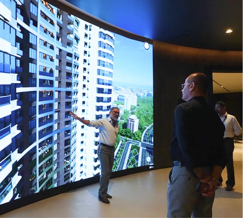
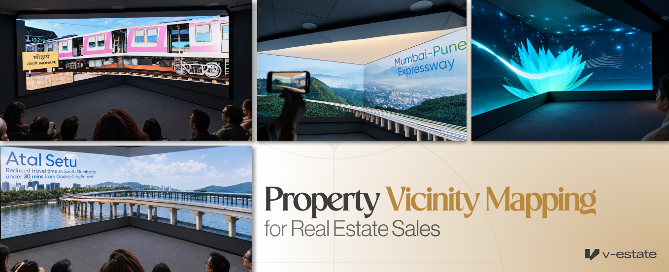
Property vicinity mapping is an interactive real estate tool that showcases a project’s surrounding neighborhood in a 3D digital environment, giving buyers complete context about connectivity networks, commercial hubs, infrastructure, social amenities, and upcoming developments. Through this interactive map, developers can present how the project connects to the wider city and major key destinations, making the location proposition tangible and easy to evaluate for the buyers.
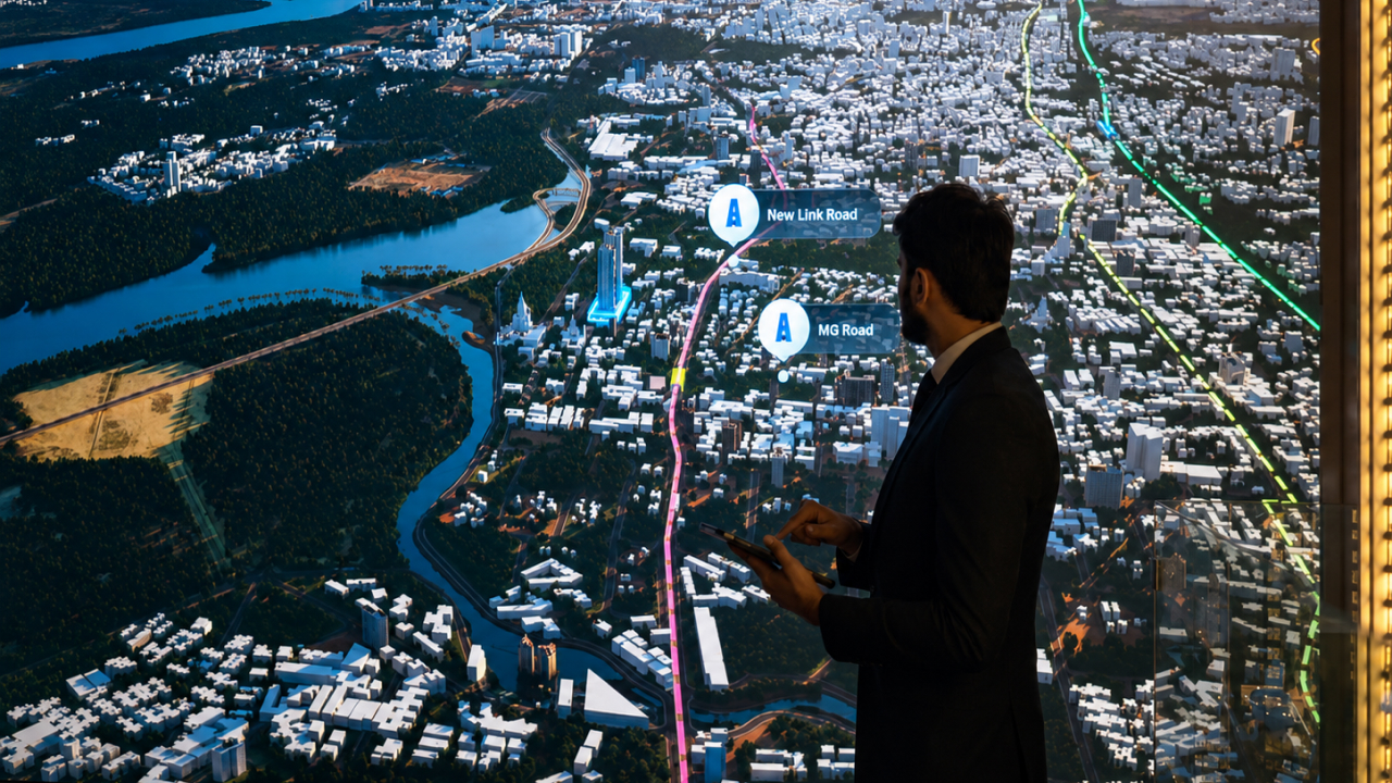
Location intelligence is a strategic asset for real estate developers. It is because by visualizing the present infrastructure alongside future growth corridors, developments, and connectivity routes, developers can showcase the project differentiation and communicate the long-term value of an address and rationale property value to the prospects. This helps buyers to take more informed and conviction-led decisions.
How Interactive Vicinity Mapping Helps Buyers to Evaluate Property’s Location Value

1. Gives Clarity About Upcoming Infrastructure
Looking at a static map with a list of proposed roads and metro stations, buyers may struggle to understand the geographic relevance of it to their property. They might even fail to understand the distance and directions of the upcoming connectivity networks with those static landmark lists from the project’s location.
With interactive property vicinity mapping, all these elements can be brought together in a 3D digital environment, helping buyers explore location advantages, connectivity, and potential impact on their everyday commutes.
Developers can even justify projects that are positioned for a premium price. For example, Narang Valora was positioned at a 30% premium positioning in the Bangur Nagar area. They used property vicinity mapping to visualize upcoming metro lines, coastal road connectivity, and other key developments surrounding the address. It helped make the location's future potential value tangible to the buyers, giving them a clearer understanding about the premium pricing that differentiates the project beyond architecture and amenities.
However, upcoming infrastructure must be clearly distinguished from operational networks to maintain buyer trust and transparency.
2. Gives Buyer Context About Social Ecosystem
Educational institutes, corporate and business parks, retail and shopping destinations, entertainment venues, religious places of worship, etc., in the surrounding vicinity, all can be showcased through one digital interface.
It helps buyers to understand how the surrounding social ecosystem can support their everyday needs and lifestyle.
3. Valuable For Selling Projects Located In Evolving Urban Micro Markets
Residential projects being developed in evolving urban micromarkets mostly rely on the upcoming developments and improved connectivity to strengthen the location value of the property to the buyers. However, it’s crucial for buyers to understand what the tangible benefits of these upcoming infrastructure projects are before they make a premium investment.
A 3D vicinity map recreates the neighborhood, upcoming metro lines, flyovers, key landmarks, and upcoming social infrastructure in an interactive digital environment, giving buyers context about how a particular location will evolve. Through this, buyers can recognize the long-term potential of an address and decide to invest in a property that is positioned at a premium ticket size.
How V-Estate Uses Property Vicinity Mapping Across Projects

Narang Valora, Goregaon
For Narang Valora, V-Estate has brought the entire Bangur Nagar growing ecosystem to life through interactive vicinity mapping to give buyers a clear understanding of the strategic location of the development to justify their 30% premium pricing.
Buyers can explore the upcoming Coastal Road, Goregaon Mulund Link Road (GMLR), Malad Versova Connector, commercial districts, educational institutions, healthcare facilities, and entertainment destinations.
With the neighborhood's changing context, buyers understand the experience of how the project's address connects with the wider infrastructure and lifestyle ecosystem.
Kalpataru Vian, Lokhandwala, Andheri West
For Kalpataru Vian, V-Estate created a 5 km vicinity mapping showcasing upcoming Pink Line metro connectivity and the proposed Coastal Road extension connecting Versova to Bandra.
Commercial hubs, educational institutions, healthcare facilities, and entertainment destinations have also been added.
Runwal One, Thane
For Runwal One metro connectivity, Eastern Express Highway access, healthcare, educational institutions, retail destinations, commercial hubs and Runwal's existing developments have been showcased through interactive vicinity mapping.
Contextual details of the surrounding infrastructure were recreated to reflect the project's real-world setting.
The visualization also helped buyers understand the development within Thane's broader urban network.
Rustomjee Crescent, Pali Hill
For Rustomjee Crescent, V-Estate did a contextual vicinity mapping covering 34 vicinity touchpoints across connectivity, social infrastructure, lifestyle destinations, and premium residential areas.
Apart from just showcasing proximity to key destinations, here, vicinity mapping helped establish the neighborhood context behind the property's premium positioning.
Make Location Value Your Next Powerful Sales Asset
Interactive property vicinity mapping helps developers create a structured visual representation for accurate context and communication of the location value of the development to the buyers.
It allows sales consultants to personalize presentations around a buyer's priorities, whether that means metro access, schools, workplaces, or lifestyle destinations.
Real estate vicinity mapping services in India are extremely important for developers building projects in top-tier cities. Especially for developers in Mumbai, projects are sold on the basis of location value due to buyer’s decisions being based on infrastructure connectivity networks and established neighborhood areas.
The objective is to make every connectivity advantage, nearby amenity, and neighborhood feature easier to explore and understand.
Book a demo with V-Estate today to turn your project's location into a compelling sales experience with an interactive vicinity mapping experience.