Picture a typical real estate site visit. A sales representative sits across from a prospective buyer, pointing to a beautifully illustrated map in a glossy brochure. "As you can see, we are strategically located just five kilometres from the central business district," they explain. The buyer nods politely, but under the table, they quietly open a navigation app on their phone. They see thick red traffic lines, a complex one-way system, and an active railway crossing. Suddenly, those five kilometres represent a 40-minute daily struggle.
For decades, the real estate industry has relied on static, 2D location maps to sell the concept of convenience. These maps use perfect concentric circles to highlight proximity to schools, hospitals, and transit hubs. However, distance is merely a geographical measurement. Connectivity is a lived experience.
When developers rely solely on static maps, they leave a critical gap in the property narrative. This gap creates friction in the sales process, forces buyers to make assumptions, and ultimately undermines the perceived value of the location. To understand why this happens, we have to look at the limitations of traditional mapping from both sides of the negotiating table.
The Difference Between Distance and Lived Connectivity
From a buyer’s perspective, purchasing a property involves mapping out their future daily routines. They do not think in kilometres; they think in minutes, convenience, and friction.
A static map might show a highly-rated school just one kilometre away from a residential tower. Geographically, this is an excellent selling point. Practically, the buyer needs to know how that journey actually feels. Is the route a quiet, tree-lined pedestrian path, or does it require crossing a dangerous, multi-lane arterial road with no pedestrian bridge?
Similarly, a map might highlight an upcoming metro station nearby. But if the map cannot convey the actual topography—such as a steep hill between the property and the station, or an industrial zone that makes the walk unpleasant at night—the buyer’s anxiety remains unresolved.
Buyers today are deeply pragmatic. When they look at a 2D map, they inherently know it is a simplified, idealised version of reality. They understand that a straight dotted line drawn by a graphic designer does not account for local bottlenecks, poorly planned junctions, or seasonal waterlogging. If a developer cannot clearly address these daily realities, the buyer will default to skepticism, severely impacting their confidence in the investment.
The Trust Deficit in Real Estate Sales
For real estate developers and sales teams, relying on traditional location maps often leads to defensive sales conversations. When a brochure claims a property is "15 minutes from the airport," and a buyer knows from personal experience that it takes 45 minutes during peak hours today, a trust deficit immediately forms.
Furthermore, developers often invest heavily in future infrastructure. They might be funding a new access road, or building near a government-approved flyover that will alleviate current traffic woes. Communicating this future value is incredibly difficult on a static piece of paper. A dotted line labelled "Proposed Road" lacks the contextual weight to convince a buyer that their commute will genuinely improve.
Sales teams end up fighting an uphill battle. They have to verbally paint a picture of a neighborhood that does not yet exist, asking buyers to trust their word over the current, visible reality outside the sales gallery window. When the primary visual aid is a flat, unmoving map, the sales narrative loses its authority. The developer's carefully planned site selection—which may have taken years of feasibility studies and negotiations—is reduced to a generic graphic that looks identical to a competitor's brochure.
How Static Maps Hinder the Buying Experience

The inability to accurately communicate connectivity has a direct impact on the broader buying experience and decision-making timelines.
When a buyer feels they do not fully understand the neighborhood context, decision-making paralysis sets in. They leave the experience centre with the intention of "doing their own research." This often means driving around the neighborhood blindly, reading outdated community forums, or relying on generic traffic apps that do not account for the developer's upcoming infrastructure upgrades.
Furthermore, static maps fail to account for different buyer personas. A young professional evaluating a property prioritises walkability to transit and local cafes. A family prioritises safe school bus routes and proximity to pediatric care. A single static map tries to speak to everyone at once, resulting in a cluttered visual that fails to answer the specific, personal connectivity questions of any individual buyer.
Upgrading the Narrative: Interactive Real Estate Connectivity Mapping

To solve this, developers must shift from presenting static geography to offering dynamic context. This involves adopting technologies that allow buyers to explore and verify connectivity on their own terms.
Interactive property walkthroughs and digital twins are increasingly expanding beyond the property boundary to include neighborhood context. Instead of a flat graphic, sales teams can utilise interactive 3D spatial visualisations of the surrounding area.
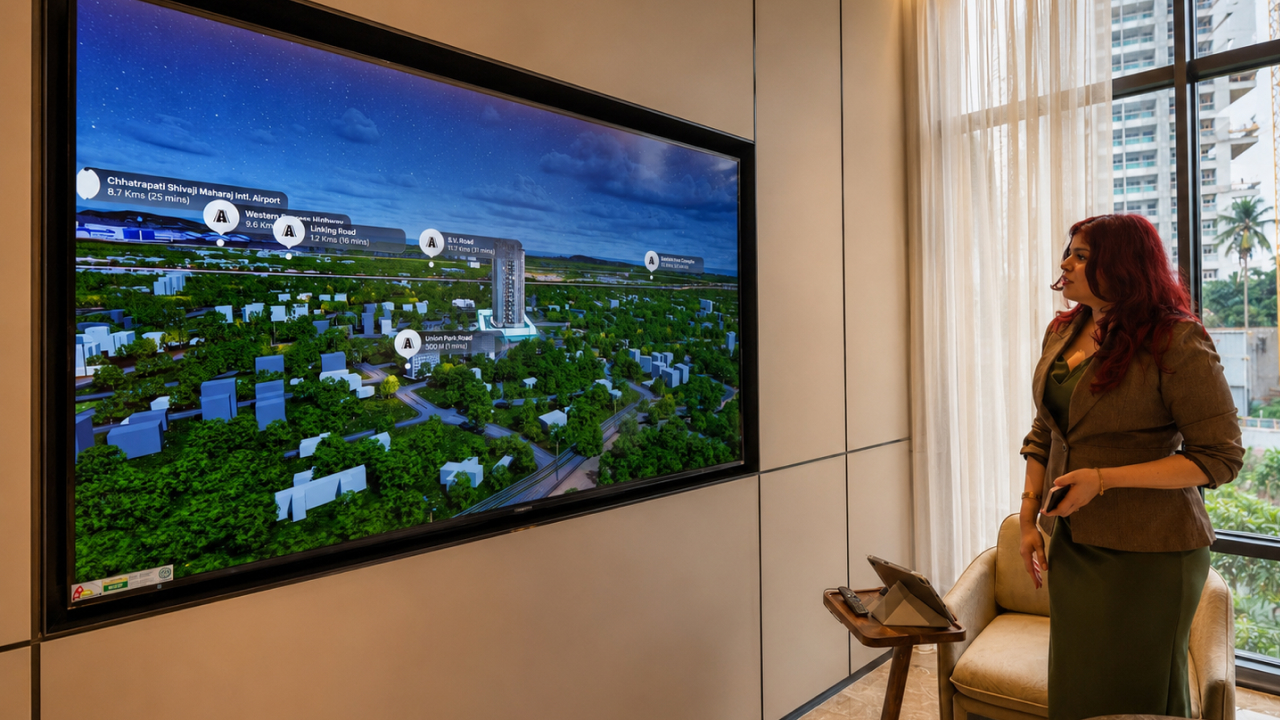
With interactive mapping, a sales professional can physically demonstrate routes. They can toggle views to show the current traffic flow versus the expected flow once a new flyover is completed. They can highlight safe walking paths to nearby amenities, or simulate the actual driving route to a major business park, accounting for one-way streets and real-world topography.
When a buyer asks about the proximity to a specific hospital, the sales team doesn't just point to an icon on a brochure. They can use experience centre technology to bring up a 3D visualisation, track the exact route, and visually demonstrate the ease of access. By acknowledging the reality of the neighborhood—including current pain points and how the developer is mitigating them—the sales team builds immense credibility.
Empowering Sales Teams with Contextual Visualisation
Addressing the connectivity question proactively requires equipping sales teams with the right tools during the presentation phase.
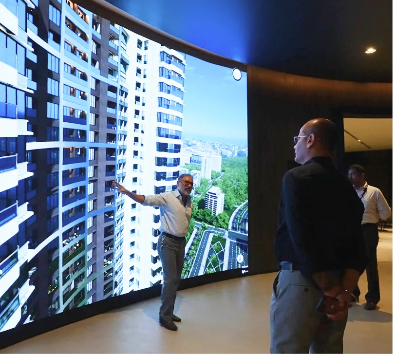
Experience centre teams should be able to guide buyers through an interactive connectivity map on large touchscreens. By interacting with the map together, the sales process becomes collaborative rather than purely presentational. The buyer can input their actual office location and see the realistic commute times visualised in a dynamic interface.
This is where dedicated spatial technology becomes highly valuable. Using interactive platforms like V-Estate, developers can replace flat brochure maps with dynamic visualisations that allow buyers to virtually navigate the neighborhood. V-Estate helps bridge the gap between the property and its surroundings, enabling sales teams to visually prove the value of the location, highlight future infrastructure in rich 3D, and tailor the neighborhood exploration to the specific priorities of the buyer sitting in front of them.
By providing this level of clarity, developers answer the unasked questions that often cause hesitation, allowing the conversation to move past geographical objections and focus on the lifestyle the property offers.
Conclusion
A property's location is often its most valuable asset, yet it is frequently under-communicated through outdated 2D mapping methods. Real estate developers spend years securing prime land parcels and analyzing infrastructure development, only to summarize that effort with a simple printed map that fails to capture the true lived experience of the neighborhood.
To build trust and accelerate decision-making, the industry must transition from showing distance to proving connectivity. By adopting interactive spatial visualisations and digital twins, real estate professionals can validate their claims, demonstrate future neighborhood improvements, and provide buyers with the clear, contextual understanding they need to invest with confidence. Upgrading how you present your location isn't just about better graphics; it is about bringing transparency and reality back into the sales conversation.