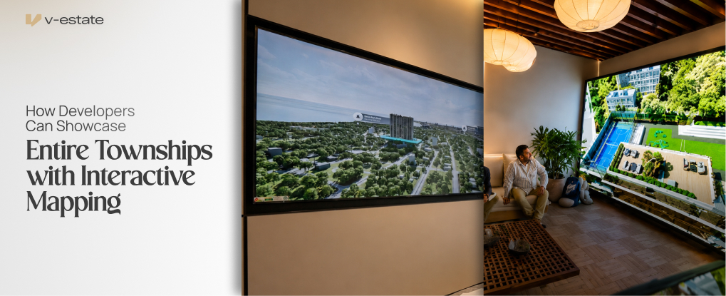
A single unit is easy to sell on its own merit. A township is a harder story to tell, because the value isn't just the flat — it's everything around it. Connectivity, amenities, phased development, nearby infrastructure. Explaining all of this verbally, or through a static map printed on a brochure, rarely does justice to the scale of the project.
This is the specific problem interactive mapping is built to solve.
Why Static Maps Fall Short for Large Projects
A printed township map shows layout, but not experience. Buyers see blocks and labels — Tower A, Tower B, clubhouse, school — without understanding how those pieces connect to their daily life. Distance on paper doesn't translate to a felt sense of convenience.
This becomes a bigger problem as township size increases. A 50-acre project might get away with a static map. A 200-acre, multi-phase township cannot. Buyers need to zoom, explore, and compare in a way paper simply doesn't support.
What Interactive Mapping Actually Provides

Interactive mapping tools let sales teams present a township at multiple scales in one continuous, guided session.
Full township overview, showing every tower, phase, and amenity block in relation to each other, giving buyers an accurate sense of scale from the first view.
Zoom into specific towers or phases, letting a buyer move from the full township down to their specific building, and then into their specific unit, without losing context.
Nearby infrastructure and connectivity, mapping proximity to schools, hospitals, transit, and commercial hubs — the details that actually influence a buying decision beyond the unit itself.
Current and upcoming project context, showing buyers what's already built versus what's planned, which matters directly for phased township sales where trust in future delivery affects today's decision.
Solving the Trust Problem in Phased Development

Township sales carry a specific trust challenge: buyers are often purchasing into phases that don't exist yet. A buyer in Phase 1 wants confidence that Phase 3's promised amenities will actually materialize.
Interactive mapping addresses this directly by showing phase-wise development plans visually, rather than as a paragraph in a brochure. When buyers can see how phases connect and in what sequence they'll be delivered, the abstract promise becomes a concrete, visual plan — which reduces hesitation tied to buying into something incomplete.
Improving the Sales Conversation for Large Projects
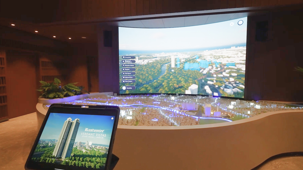
Interactive mapping also changes how sales executives handle large-scale walkthroughs. Instead of describing the township verbally and hoping the buyer retains it, the executive can guide a visual journey — starting broad, then narrowing based on what the specific buyer cares about most, whether that's school proximity, greenery, or connectivity to a work hub.
This flexibility matters because different buyers within the same township have different priorities. A family buyer cares about schools and parks. A working professional cares about commute time and connectivity. Interactive mapping lets one tool serve both conversations without needing separate materials.
Reducing Repeat Visits for Large-Scale Decisions

Township purchases are high-value decisions, and buyers often want to revisit questions about location and amenities multiple times before committing. When the first sales session already answers most of these questions clearly, through zoomable, interactive context, fewer follow-up visits are needed to close the sale.
This directly improves cost per acquisition for large township projects, where the sales cycle is typically longer and more visit-intensive than single-tower projects.
Mental Ownership at Township Scale
The same psychological principle that applies to individual units applies here at a larger scale. When a buyer can trace their daily commute, locate their child's school, and see their unit's specific position within the township — all in one interactive session — they build a felt sense of belonging to the project. This is mental ownership applied to an entire community, not just four walls.
Where This Technology Belongs
As with other real estate visualization tools, interactive township mapping delivers the strongest results as an offline, in-centre activation, guided by a sales executive inside the sales office. It is not meant to function as a public, self-serve web map. The guided format ensures buyers get context and interpretation alongside the visual, rather than navigating a complex township layout alone.
Ready to help buyers see the full scale of your township, not just a single unit? V-estate offers offline, in-centre interactive mapping that takes buyers from a full township overview down to their specific unit, guided by your sales team. Get in touch to bring this into your next launch.